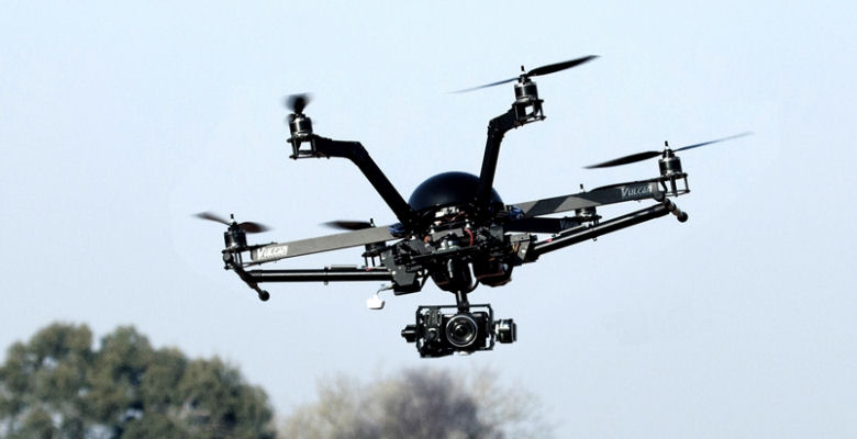
How drone research is driving global technology
This has led to this establishment of the LJMU Drones Research Laboratory and interdisciplinary work between the School of Natural Sciences and Psychology, the General Engineering Research Institute (GERI) and Open Labs.
Orang-utans conservation carries forward to data collection
Orang-utans conservationProfessor Serge Wich from the School of Natural Sciences and Psychology has led world-leading research using drones for orang-utans conservation since 2011, and along with conservation ecologist Lian Pin Koh, founded ConservationDrones.org to share their experiences of unmanned aerial vehicles (UAV) building and applications with the public.
“Having seen such success with the drones, I wanted to get more discussions going between researchers and businesses about the technology that is out there and the benefits it can bring,’ Professor Wich says. ‘Drones will probably be a standard tool in biodiversity surveys in the future, so it is important that universities can use this technology and pass on knowledge to students, for future employment.
“Equally, it is important that organisations know we are using and developing this and other technologies. Using cutting-edge technology is also exciting for students, particularly if they can build it themselves. Drones will change data collection in huge ways; they have the power to revolutionise environmental research and conservation.”
Some of the examples of drone research taking place at LJMU is highlighted below.
Google Maps
The partnership between Google and LJMU includes the hosting and processing of drone data for land cover classification. This means that their maps can now be viewed in high-resolution by everyone and the satellite imagery available is a unique resource.
From the built environment to the Barrier Reef
Working with GERI and Open Labs, the drones research involves talks and workshops on how drones can be used across a range of areas from aerial cinematography for the film and television industries through to built environment and archaeology.
This includes working with other universities, with a recent workshop taking place at the University of Oxford Wildlife Conservation Research Unity.
The Open Labs team are also working with Australian academics and Google to map above and below the Heron Reef, Queensland collecting data at different temporal and spatial resolutions.
At this two-day workshop Serge Wich and Andrew Goodwin (Open Labs) gave an overview of the potential applications of drones for conservation in combination with introductory sessions on how to use drones and post-process data. The Open Labs team are also working with Australian academics and Google to map above and below the Heron Reef, Queensland collecting data at different temporal and spatial resolutions.
Andrew Goodwin, who leads the Open Labs’ Foresight programme, commented on this:
“Open Labs has identified a global opportunity around the use of unmanned aerial systems (or drones) that LJMU specialist expertise and local industry is particularly well placed to respond to. We have been raising awareness and building capacity through our Civic Drones programme with the intention of generating research and commercial partnerships between companies from across the City Region and partners from across the University.
Rob Tilly, IronBird Aerial Cinematography Ltd, explained the benefits to his company:
“The Civic Drones Programme has allowed us to talk directly to people within collaborative industries about what we do and how we do it. The key to this is education, the more people who we can educate about our business, the more our services are used. LJMU has been a bridge for us to reach potential clients, and the ever-enthusiastic team at the Civic Drones Programme have really helped us motivate ourselves within the local Drone community.”
Power supply and distribution
The GERI team are currently developing drones to monitor electrical power distribution systems to increase the security of supply, particularly in more remote areas. Drones are also being developed which will fly along the paths of the distribution network checking for structural integrity and encroaching vegetation that might interfere with power distribution especially in poor weather conditions.
Historic conservation in 3D
Recent discussions between the LJMU Drones Research Laboratory Team and National Museums Liverpool have unearthed important applications for drones nearer to ome. These include the photographic and 3D surveying of the interiors of historically important buildings which are such poor states of repair that they cannot be saved – or indeed even entered safely. The drones will fly in where everyone else fears to tread and preserve a record of these important sites.
Professor David Burton, who leads the LJMU Drones Research Laboratory, said:
“We are only just beginning to see the potential of these devices. For example, to capture a complete archaeological site in 3D would have been impractical before, it would simply take far too long and cost too much, but with a fleet of drones operating semi-autonomously it becomes a perfectly achievable vision. Drones, like many technologies, have good and bad aspects. It’s up to us, the researchers, the users and society at large to harness the enormous benefits they could bring into just about every aspect of our life – the everyday and the exceptional.
Counting geese
The team are also linking in with non-governmental organizations (NGOs) and research groups to answer their research and conservation questions for instance the World Wide Fund for Nature (WWF) who are looking at rhinos in Nepal’s national parks and a group in Malaysia who are studying elephants. This involves training people on how to look at the images from the drones and helping them fine-tune the details. Drones have even been used to try to count geese in Scotland for the Wildfowl and Wetlands Trust and the ConservationDrones Asia Team and the Sumatran Orangutan Conservation Programme (SOCP) recently used drone images to stop illegal logging within the Gunung Leuser National Park (Indonesia).
Conservation in developing countries
Professor Wich added: “The goal of our drone research, whether this is focussing on wildlife, high-resolution drone mosaics or working with businesses, is to inspire others to adapt emerging technologies for conservation. We want to share our knowledge of building and using low-cost unmanned aerial vehicles for conservation-related applications with conservation workers and researchers worldwide, especially those in developing countries.”