

Field Trips
Ribble Valley River
The River Ribble runs through North Yorkshire and Lancashire in Northern England. It starts close to the Ribblehead Viaduct in North Yorkshire and is one of the few that start in the Yorkshire Dales and flow westwards towards the sea.
 The catchment covers an area of over 750 square miles and contains more than 3479 miles (5,600 kilometres) of watercourses. It also includes the Calder, Hodder, Darwen, and Douglas sub-catchment. Across this area is a diverse and varied types of habitat, from farmland, to woodland, to cities and industrial areas. This variety of habitats means there is huge variety of fish, mammals and invertebrates that call this area their home.
In the past, industrial and agricultural pollution as well as water abstraction for drinking water and poor sewage treatment have caused severe habitat damage to the Ribble catchment, to such an extent that the wildlife supported by the river has been put under threat.
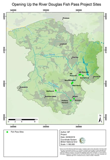
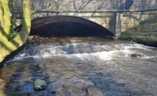
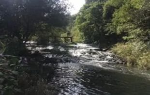
Ribble Rivers Trust is a UK based charity working to improve, protect and promote the River Ribble for both people and wildlife. Following the principle of integrated river basin management and the Water Framework Directive, the trust delivers several projects of renaturalization, the Opening Up the River (OUR) Douglas Project is a £1mil project which aims to create a healthier river environment by facilitating fish passage between Gathurst and Horwich. The trust is reconverting several weirs using engineering with nature solutions for fish passages.
Delegates will join the group of scientist and engineering working from the trust to attend initially a forum on the intervention on planned and the site, the impacts achieved. This will be followed by a lunch break at one of the characteristics local venue that the Ribble Valley offers. Delegates will then move to the various site of intervention with the trust staff with additional technical discussion on site.
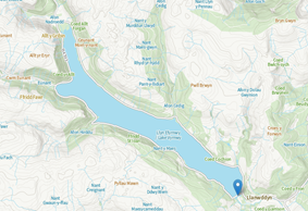
Llanddwyn Dam
Lake Vyrnwy Dam, Llanwddyn, is a large masonry dam built by the Corporation of Liverpool in 1881-8 to create Vyrnwy reservoir to provide a water supply to Merseyside and Liverpool. The dam, located about 1h30 from Liverpool, is of the gravity type in neo-Baroque style, measuring 358m long and 44m high, and topped with a carriageway of 31 arches. There are groups of four towers at either end of the central arch section, each capped with a pyramidal stone roof. There are two transverse discharge tunnels at the base of the dam.
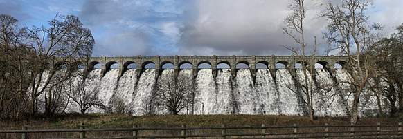
The dam was the first to be constructed with a system of drainage tunnels incorporated to prevent the build-up of pressure beneath the base. The dam is depicted under construction on OS County series mapping (1891), with quarries, tramways, workshops and workers housing. It has the status of Listed Grade I for its national importance as an outstanding achievement of Victorian water engineering and as one of the most impressive examples of industrial architecture in Wales.
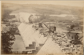
Llanddwyn Dam reservoir and archive image during the construction in 1886 (coflein.gov.uk)
The visit will start first joining technicians of the Dam for a first introduction on the design and maintenance of the dam and reservoir operation, followed by a lunch break and the visit to the dam, reservoir and maintenance tunnels together with the technical staff for further discussion.
Banner credit: Mersey Gateway Project